Geospatial Intelligence Desk
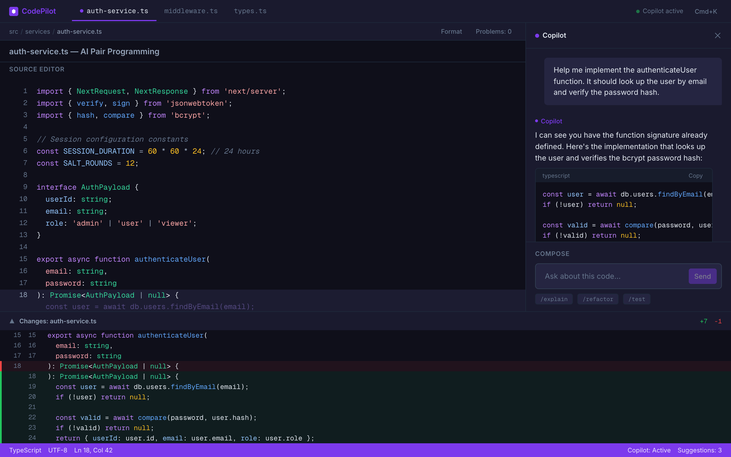
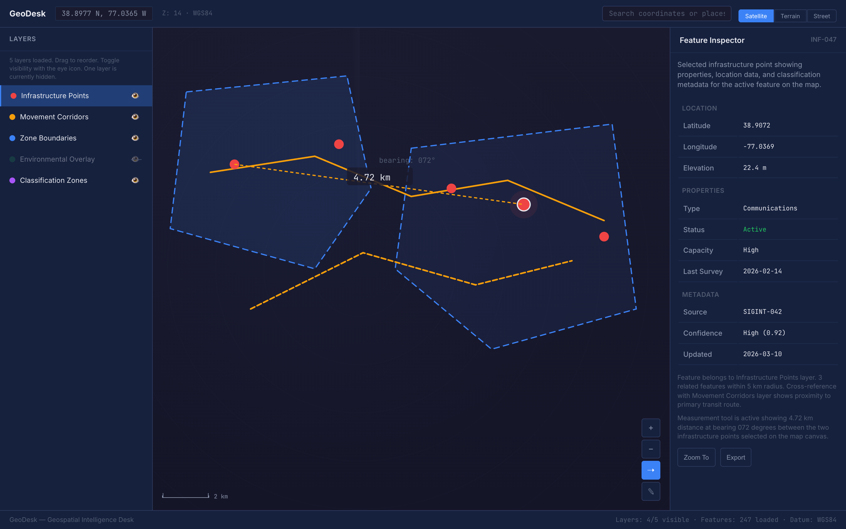
A cartographic-precision dark map analysis workspace with layer management, measurement tools, coordinate readouts, and feature inspection panels for intelligence and geospatial data analysis.
Design Language
A dark-themed, military-grade geospatial analysis workspace featuring layer stack management, precision measurement tools, coordinate search, satellite/terrain toggles, and feature inspector panels, all built on cartographic visual language with topographic contour motifs and a strict primary/secondary/tertiary information hierarchy.
Agent instructions (SKILL.md)(advanced)
Design Skill
This Design Skill provides a comprehensive dark-themed geospatial analysis workspace language. It establishes cartographic precision with military-grade information hierarchy, layer stack management, coordinate readouts in monospace, measurement overlays, and feature inspector panels, all rendered on a dark navy map canvas that maximizes data overlay visibility.